

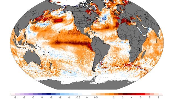

The highly anticipated El Niño has arrived, and it is already proving to be noteworthy. Earlier this year, climate experts predicted the development of an El Niño in the central Pacific region. Subsequently, more models began indicating a potentially strong or “super” El Niño, though uncertainties remained.
In June, the U.S. National Oceanic and Atmospheric Administration (NOAA) released its monthly update, officially declaring an El Niño advisory due to elevated temperatures in the specific Niño 3.4 region of the Pacific Ocean. For an El Niño classification, temperatures in this area must exceed 0.5 degrees Celsius above normal. Currently, ocean temperatures are nearly 2 degrees Celsius above average, marking a record high for this time of year.
According to Zeke Hausfather, a climate scientist from Berkeley Earth, the Niño 3.4 region is already experiencing temperatures above 2 degrees Celsius, indicating significant El Niño conditions. Forecasts suggest a potential peak for El Niño in October, with a likelihood of November or December for the climax.
El Niño and La Niña are components of the larger El Niño Southern Oscillation (ENSO) cycle, affecting the Pacific Ocean region. While La Niña brings cooler temperatures, El Niño brings warmer conditions. The transition from La Niña to El Niño has been notably swift this year, according to Nat Johnson, a meteorologist at NOAA.
The strongest El Niño in recent memory occurred in 2015-2016, with an ocean temperature anomaly of approximately 2.75 degrees Celsius. This rapid shift from La Niña to El Niño raises questions about the underlying causes, with some speculating on the influence of climate change.
The implications of this powerful El Niño extend to food security, potential droughts in tropical regions, and altered winter conditions in Canada, including milder temperatures and drier weather conditions. Experts caution that El Niño should not be underestimated, emphasizing its significant impacts on various sectors.