

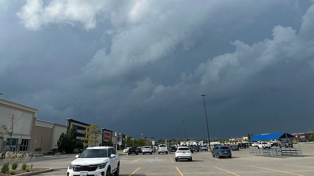

A tornado watch has been canceled for London and Middlesex County after severe weather swept through southwestern Ontario in the afternoon.
As of 7 p.m., a yellow heat warning remained in effect for the London area, while a tornado watch was still active for Norfolk County.
Following a strong storm originating from Michigan that crossed Lake Huron and hit the region around 5 p.m., thousands of residents in Huron, Lambton, and Perth counties were left without power.
In areas like Grand Bend, Lambton Shores, and Goderich, nearly 8,500 people experienced power outages. According to the Hydro One outage map, power restoration was anticipated by 7:30 or 7:45 p.m.
In London, power was disrupted in the Blackfriars and West London areas due to a small branch on a power line along Empress Avenue. London Hydro estimated power to be back by 10:30 p.m.
The storm system prompted a red thunderstorm warning for regions north of London and along the Lake Huron shoreline from Ipperwash to Goderich. Additionally, a red tornado warning was issued for areas including Clinton, Mitchell, Seaforth, and Vanastra. However, the warning was lifted as the storm moved eastward.
Although it is uncertain whether a tornado or downburst occurred, there have been no reports of significant damage so far.
Authorities are responding to various service calls throughout Perth County due to the severe weather. Police are advising the public to limit non-essential travel until the weather system passes.
Environment Canada first issued an orange-level tornado watch at 4:25 p.m., cautioning about potential thunderstorms capable of producing tornadoes with strong winds, large hail, and heavy rain.
Meteorologist Rob Kuhn highlighted the heightened risk between 4 p.m. and 8 p.m., warning of potential torrential rain, large hail, and damaging winds. The possibility of isolated tornadoes was also mentioned by Kuhn.
A thunderstorm quickly moved through London in the early afternoon, bringing heavy rain and hail to some areas.
Environment Canada advises people to stay updated on weather alerts and forecasts. In case of a tornado warning, individuals should seek shelter indoors on the lowest floor away from windows and exterior walls.
The tornado watch coincides with an extreme heat advisory for the London area. With daytime temperatures reaching 32°C and a humidex making it feel like 41°C, precautions against heat-related illnesses are advised.
Overnight temperatures are expected to drop to 19°C with a continued risk of thunderstorms. Thursday will be mainly cloudy with a chance of showers and a high of 27°C, feeling like 35°C. Friday and Saturday will remain cloudy with chances of showers and highs of 26°C and 24°C, respectively.